Checking Natural Hazards Before You Buy in Myoko: Floods, Volcanoes, Quakes
If you are an Australian looking at a house in Myoko, you will check the price, the snow and the drive to the lifts. This guide adds one more check: the natural hazards at that exact address. Japan's national and local governments publish free maps for flooding, landslides, volcanoes and earthquakes, and most of them work from a street address. Below we explain where each one lives, what it shows, and what it does not show.
Everything here comes from official pages. They are published by Myoko City, the Ministry of Land, Infrastructure, Transport and Tourism (MLIT), the Geospatial Information Authority of Japan (GSI), the Japan Meteorological Agency (JMA), the Headquarters for Earthquake Research Promotion and the National Research Institute for Earth Science and Disaster Resilience (NIED). We read them all on 24 September 2026. This is general information, not a safety survey of any property. For a specific house, ask the city, your real estate agent or a qualified surveyor or engineer.
Start with the national portal: one address, several hazards
The quickest first look is the Hazard Map Portal Site, run by MLIT and GSI. It has two parts.
- Overlay hazard map (Kasaneru Hazard Map): you type in an address and see the risk at that point. It covers floods, landslides, storm surges and tsunamis. It can also show road hazard information and how the land was formed. Since July 2026 it can show designated evacuation shelters as well.
- Local hazard maps (Wagamachi Hazard Map): links to the maps that each city or town has made and published under the law. You can pick maps by type, including flood, landslide and volcano maps.
The portal gathers other agencies' data in one place. It says that questions about what the data means should go to the agency that made it. For Myoko, that is often the city or Niigata Prefecture.
Myoko City's own guidebook and hazard maps
Myoko City has published a new disaster guidebook with hazard maps. The city split it into PDF files by page, with area maps covering the city. The city asks residents to do three things with it:
- find your home on the map and check whether it is in a flood or landslide danger area;
- check the designated shelters and a safe route to one, and think about more than one place to go, such as a relative's home or a hotel;
- agree a plan with your family, and write a personal evacuation timeline.
Two changes matter if you looked at an older map. First, the new maps add flood information for 16 smaller rivers in the city, on top of the main rivers. The city warns that some places people thought were safe on the previous map now show a flood risk. Second, every weather warning now carries a level from 1 to 5. At level 4, everyone must leave dangerous places.
What the flood maps can and cannot tell you
Myoko City also shows flood zone maps made by Niigata Prefecture for the Seki, Yashiro and Shibue rivers on the city's online map system. The city adds two warnings:
- the maps are based on set assumptions, so an area with no colour on the map may still flood;
- river works, landform changes and new land use since publication may mean a map no longer matches the ground.
If you buy through a licensed agent, you will see a flood map
Since 28 August 2020, real estate agents in Japan must show you where the property sits on the flood hazard map. This is part of the formal explanation of important matters that comes before a contract. MLIT's guidelines say the agent should use the latest map published by the city or town and show roughly where the property is. It is also desirable for the agent to show where the shelters on the map are. And the agent should take care that you do not assume there is no flood risk just because the property is outside a mapped flood zone.
This covers flood maps made under the Flood Control Act. It does not replace your own look at landslide, volcano and earthquake information.
Volcanoes: Myoko-san and Niigata-Yakeyama
JMA defines an active volcano as one that has erupted within roughly the last 10,000 years, or one with vigorous fumarolic activity now. Japan has 111. Two of them matter most for Myoko.
Myoko-san
- Current forecast: JMA's forecast for Myoko-san is the general one for active volcanoes: "keep in mind that this is an active volcano". JMA says activity is calm, with no signs of an eruption that would affect the area around the crater.
- History: JMA's summary says there is no recorded volcanic activity in historical times. The latest magma eruption was about 4,200 years ago. The Akakura and Ōtagirigawa pyroclastic flows, about 5,300 and 4,200 years ago, reached the foot of the mountain.
- Gas: JMA notes that fumaroles and volcanic gas can occur in the crater area, and that high levels of toxic gas can collect in hollows and valleys.
Niigata-Yakeyama
- Current forecast: Volcanic Alert Level 1 ("keep in mind that this is an active volcano"). JMA lists Itoigawa City and Myoko City as the municipalities covered.
- Monitoring: JMA lists Niigata-Yakeyama as a volcano under constant observation. It uses seismometers, tiltmeters, infrasound sensors, GNSS and cameras.
- History: the last magma eruption was in 1773. Small steam-driven explosions happened in the 20th century. JMA also notes that the volcano easily produces mudflows.
How to read the alert levels
Volcanic Alert Levels run from 1 to 5. Each level tells you which area needs caution and what people should do. JMA points out three things worth remembering:
- a volcano can erupt without warning signs, and the level does not always move one step at a time;
- the areas and actions for each level differ by volcano and are set in the local disaster plan;
- mudflows during rain are not covered by eruption warnings, so watch heavy rain information too.
The current forecast for each volcano is on JMA's volcano pages.
Earthquakes: odds for the next 30 years
Japan's Headquarters for Earthquake Research Promotion publishes the National Seismic Hazard Maps. The probabilistic maps show the chance of shaking at or above a given level over a fixed period. One example the headquarters gives is a map of the probability of shaking of JMA seismic intensity 6-Lower or higher within the next 30 years. The 2020 edition uses 1 January 2020 as its reference date, and its English translation was released in January 2026.
To look up a Myoko address, use J-SHIS, the Japan Seismic Hazard Information Station run by NIED. It shows the national maps on a zoomable web map with grid cells of about 250 m, and you can search by address or postcode. We have not quoted a figure for Myoko here, because the number depends on the exact grid cell. Look up the address you are considering.
A short checklist before you sign
- Put the address into the national overlay hazard map and note the flood and landslide results.
- Open Myoko City's new guidebook, find the area map for the address, and note the nearest shelter.
- Read the current JMA pages for Myoko-san and Niigata-Yakeyama.
- Look up the address on J-SHIS for the 30-year shaking probability.
- When the agent explains the flood map, remember that "outside the flood zone" is not the same as "no flood risk".
- Ask the city or a qualified professional about anything that is unclear. The maps are a starting point, not a verdict on one house.
What we could not verify, and therefore left out
The shaking probability for particular Myoko locations (J-SHIS shows it only in an interactive map, which we did not quote); the contents of Myoko City's snow damage pages and area map PDFs (they are image files we could not read as text on the day); the extent of the volcanic hazard maps for Myoko-san and Niigata-Yakeyama; and whether any particular street or house is in a mapped danger area.
Related guides
- Buying Property in Japan as a Foreigner: An Australian Guide
- Myoko Ski Areas and Snowfall: What the Official Records Show
More from the Journal
Browse every guide in the Myoko Kogen Journal. This guide is general information, not a survey, legal or engineering advice.
Sources
All URLs retrieved 2026-09-24.
- MLIT / GSI — ハザードマップポータルサイト (Hazard Map Portal Site: overlay map, address search, hazards covered, shelters added July 2026, questions to the data's maker): https://disaportal.gsi.go.jp/
- MLIT / GSI — わがまちハザードマップ (local hazard maps by type, including volcano maps): https://disaportal.gsi.go.jp/hazardmap/index.html
- Myoko City — 妙高市防災ガイドブック・ハザードマップ (new guidebook; three checks; 16 smaller rivers added; warning levels 1 to 5): https://www.city.myoko.niigata.jp/docs/81083.html
- Myoko City — 妙高市内の浸水想定区域図 (prefecture flood zone maps for the Seki, Yashiro and Shibue rivers; cautions): https://www.city.myoko.niigata.jp/docs/450.html
- MLIT — 不動産取引時において、水害ハザードマップにおける対象物件の所在地の説明を義務化 (flood map explanation required from 28 August 2020; guideline points): https://www.mlit.go.jp/report/press/totikensangyo16_hh_000205.html
- JMA — 活火山とは (definition of an active volcano; 111 active volcanoes): https://www.jma.go.jp/jma/kishou/know/kazan/katsukazan_toha/katsukazan_toha.html
- JMA — 妙高山の活動状況 (current forecast; gas cautions): https://www.data.jma.go.jp/vois/data/tokyo/STOCK/activity_info/308.html
- JMA — 妙高山 (overview and eruption history): https://www.data.jma.go.jp/vois/data/tokyo/308_Myokosan/308_index.html
- JMA — 新潟焼山の活動状況 (Alert Level 1; municipalities covered): https://www.data.jma.go.jp/vois/data/tokyo/STOCK/activity_info/307.html
- JMA — 新潟焼山 (overview, eruption history, monitoring): https://www.data.jma.go.jp/vois/data/tokyo/307_Niigata-Yakeyama/307_index.html
- JMA — 噴火警戒レベルの説明 (Volcanic Alert Levels and cautions on using them): https://www.jma.go.jp/jma/kishou/know/kazan/level_toha/level_toha.html
- Headquarters for Earthquake Research Promotion — National Seismic Hazard Maps for Japan (2020) (English report page; translation released January 2026): https://www.jishin.go.jp/main/chousa/26jan_yosoku-e/index-e.htm
- Headquarters for Earthquake Research Promotion — Key points for the National Seismic Hazard Maps for Japan (2020) (probabilistic maps; 30-year probability of intensity 6-Lower or higher; reference date): https://www.jishin.go.jp/main/chousa/26jan_yosoku-e/Key_points_for_the_National_Seismic_Hazard_Maps.pdf
- NIED — J-SHISについて (J-SHIS: national maps on a web map, about 250 m grid, address and postcode search): https://www.j-shis.bosai.go.jp/about
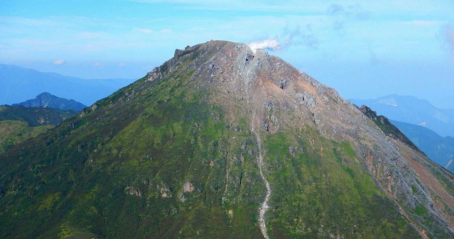
Header photo: “Mount Yake, an active volcano on the border of Myoko and Itoigawa, with a thin plume of steam at the summit” (Ministry of the Environment, Japan / 環境省), https://www.env.go.jp/nature/nationalparks/list/myoko-togakushi-renzan/spot/. Edited (cropped and resized) for use as the header image on this page. Used under the Public Data License (PDL) Version 1.0.
