The Sekikawa Barrier and the Hokkoku Kaido: Myoko's Old Road and Checkpoint
Drive south from Myoko Kogen towards Nagano and, just before the river that marks the prefectural border, you pass a small village called Sekikawa. In the Edo period, this was where travellers on the Hokkoku Kaido, the old highway between Niigata and Nagano, were stopped and checked. If you are looking at a house in Myoko, this short guide explains what the checkpoint was, what the old road left behind, and how to visit the rebuilt barrier and its museum.
Everything below comes from Myoko City's page for the museum, the city's 2018 plan for its historic sites (published on the Agency for Cultural Affairs website), and the Japan Tourism Agency's multilingual guide text. We read all of them on 18 November 2026. Opening times and fees can change, so check with the museum before you go.
The Hokkoku Kaido: Myoko's old main road
The Hokkoku Kaido linked Shinshu (today's Nagano) with Echigo (today's Niigata). The city's plan names Karuizawa as its starting point, and Izumozaki and Sado Island at the far end. Myoko City calls it an important route that developed next in rank to the five great highways of the Edo period, such as the Tokaido and the Nakasendo.
The city's plan says the road began as a military route in the Warring States period, when a system of post horses was set up along it. In 1611, rules for its post towns were laid down, and the Hokkoku Kaido became an official highway.
The plan describes three main uses for the road and the related Kaga Kaido:
- Pilgrims heading for Zenkoji temple in Nagano. As ordinary people grew better off, trips to temples and hot springs became popular, and the road was busy with them.
- Gold shipments (gokin-ni). The city links this to the gold and silver mines of Sado.
- Daimyo processions, the large formal journeys that feudal lords made to and from Edo.
The slopes below Mt Myoko are cut by deep ravines. For safe travel, eight post towns were opened on the stretch between Arai and Sekikawa, where the checkpoint stood.
What the Sekikawa barrier was
A sekisho was a checkpoint on a highway. The Japan Tourism Agency's guide text explains that in the Edo period (1603–1867) the shogun controlled checkpoints on the highways into and out of Edo, modern Tokyo. Officials used them to regulate trade and to search travellers for weapons, rebels and criminals.
The Sekikawa checkpoint stood on a river terrace just before the Seki River, which forms the border between Niigata and Nagano. The city's plan records these points about it:
- In the Edo period it was counted among the "important checkpoints" (omoki sekisho) set by the shogunate.
- On the shogunate's orders, the Takada domain ran it, and placed duties on the surrounding villages to keep it going.
- It is also said that the Uesugi clan set up a checkpoint here in the Warring States period to collect tolls from travellers.
Sekikawa was not the only control point near the border. The plan notes that, for public order, checkpoints and smaller guard posts were placed along the provincial border. One example is the Nagasawa guard post on the Iiyama road, run by the Takada domain to check goods and suspicious people. Today a stone marker stands at its site.
The rebuilt checkpoint and the museum
In 1997 the guardhouse buildings and the gate were rebuilt on the site of the old checkpoint. A visitor centre, the Sekikawa Sekisho Michi no Rekishikan ("road history museum"), was opened next to it. Myoko City says the museum recreates the checkpoint as it was.
According to the city, the information hall has old documents and dioramas about the checkpoint's history. An upstairs room shows material on travel and daimyo processions of the time. A large screen in the "highway theatre" shows three short films.
The Japan Tourism Agency's guide text adds that exhibits have descriptions in Japanese and English. It also says visitors can walk through the rebuilt checkpoint, and that dress-up props such as kimono are offered.
Visiting: season, hours and fees
- Season: 10 April to 30 November. The city's notice says the museum is open until 30 November this year.
- Hours: 9 am to 5 pm, with last entry at 4:30 pm.
- Admission: ¥500 for high school students and adults; ¥300 for primary and junior high school students.
- Phone: 0255-86-3280. The city asks people to call the museum for details of special exhibitions and events.
Until 30 November 2026, the museum is running a special exhibition called "A journey along the Hokkoku Kaido". The city also notes a restaurant next door, open from late April to around mid-November. The city recommends its local handmade soba.
The old post towns of Sekikawa and Uehara
The city's plan treats Sekikawa as a district built around the old road. It centres on Sekikawa and Uehara, the two Edo-period villages that served as post towns and supported the checkpoint. The plan lists several things to look for:
- Two gardens of old inn houses, designated by Myoko City in 2016 as the Hokkoku Kaido post-town gardens. One belonged to a house that served as the official inn for the Kaga domain's lord, and the Emperor Meiji later stayed there on his tour of the Hokuriku region. The other belonged to an inn in Uehara.
- A great cedar at Tenjinsha shrine, which is a national natural monument. The plan calls it the largest tree in the city.
- A haiku stone for Kobayashi Issa at Jozenji temple, and a poem stone for the poet Horiguchi Daigaku.
- A garden on the checkpoint site itself.
The plan also mentions a "Sekisho Festival" held every September by local groups. It notes that local groups made a walking map and put up signs in 2015 and 2016.
Why it matters if you live in Myoko
The old road still shapes the area. The city's plan notes that National Route 18 runs along the former Hokkoku Kaido route through the city. Village names such as Sekiyama and Sekikawa, and the many shrines and old houses along the route, make more sense once you know a highway once ran through them.
The museum is also an easy half-day outing for visiting family or friends, and it has English descriptions. It is closed through the winter, so plan visits between April and November.
What we could not verify, and therefore left out
- Whether the two post-town gardens are open to visitors. The city's plan describes them, but we found no official page on access. Treat them as private homes unless you are told otherwise.
- The exact date of the Sekisho Festival for any given year. The plan only says it is held each September.
- The exact year the checkpoint was first set up. The plan records the Uesugi toll checkpoint only as something that "is said" to have happened.
- Group discounts and winter opening. Some travel sites mention these, but the city's page does not, so we left them out.
- Visitor numbers today. The plan's figures stop at 2016, so we did not use them.
Related guides
- Sekiyama Shrine and Its Fire Festival: Myoko's Mountain Worship Heritage
- How Myoko Kogen Became a Resort: Akakura Onsen and the First Ski Slopes
More from the Journal
Browse every guide in the Myoko Kogen Journal. Our articles are general information only; check opening times and fees with the facility before you visit.
Sources
All URLs retrieved 2026-11-18.
- Myoko City — 関川関所道の歴史館 (Sekikawa checkpoint road history museum: 2026 season notice, exhibits, season, hours, fees): https://www.city.myoko.niigata.jp/docs/848.html
- Myoko City Board of Education — 妙高市歴史文化基本構想 (Myoko City historical and cultural basic plan, March 2018; Hokkoku Kaido, Sekikawa checkpoint, Sekikawa district), published on the Agency for Cultural Affairs website: https://www.bunka.go.jp/seisaku/bunkazai/rekishibunka/pdf/r1392234_115.pdf
- Japan Tourism Agency multilingual commentary database — Seki River Border Checkpoint: https://www.mlit.go.jp/tagengo-db/en/H30-00581.html
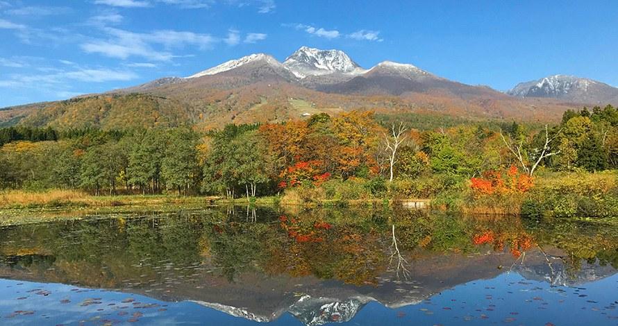
Header photo: “Mount Myoko with early snow, reflected in the still water of Imori Pond, with autumn trees along the shore” (Ministry of the Environment, Japan / 環境省), https://www.env.go.jp/nature/nationalparks/list/myoko-togakushi-renzan/spot/. Edited (cropped and resized) for use as the header image on this page. Used under the Public Data License (PDL) Version 1.0.
